
Itinerary, description of stages, practical informations, accomodation, GPS tracks from Cluny to Le Puy (in part by GR7 trail) on the way to Santiago.
Cluny to Fay sur Lignon
From Cluny to Le Puy, a way exists : Cluny-Le Puy . It’s going to Loire Valley. As I prefer hills and mountains, I choosed to walked in part on the GR76 and the GR7. These paths are often on the watershed. To the west, the landscape is heavily forested, mountainous environments. To the east, it’s a countryside with cultures and vineyards.
In some points, the views to the Alps are superbs.
Websites :
GR7 : There’s a guidebook for GR7 from the FFRP (French Federation of Randonnée Pédestre). The Comité Départemental de Randonnée Pédestre de Haute Loire, you can upload a PDF file with accomodations on the GR7.
From le Puy to Conques : a good guide to download with accommodation, tourist information … : guide (in french) du Puy à Conques
Maps on the web :
France (maps of the Institut Géographique National) : http://www.geoportail.fr/ with Applestore application : Iphigénie http://iphigénie.com/?lang=en
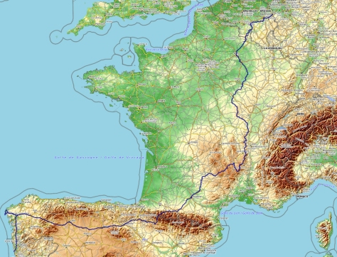
My way from Aachen to Santiago
Linked with the image below : the GPS track of all the hike (this GPS track has been remade after the hike)
My daily stages
| 35 | Cluny – Cenves |
| 32km | Stage profile : I wanted to go up to the Roche de Solutré. So it’s longer than the usual way. By the way I walked, it’s 1000m of ascent – steep up just after Cluny, to go up to Solutré rock, up to Cenves forest and the last one to the village |
| 8h45 | Notes :Very beautiful stage, both natural and historical places. From Cluny, GR76 through Montmain cross until Berzé le Châtel. A part of the “Green way / Voie verte”. I passed by the chapel of the castle of Cluny’s monks. Then la Roche Vineuse, Vergisson, up to Solutré rock. Then to Grange du Bois pass and on the GR76A : orientation table of Rontécolon and Cenves |
| Logistics : shops in La Roche Vineuse. Beautiful gite in Cenves. Bar-restaurant in Cenves | |
| 36 | Cenves – Saint Nizier d’Azergues |
| 33km | Stage profile : steep up after Beaujeu. 1000m of ascent for the day |
| 9h | Notes : From Cenves, trail straight to Siberia pass, Fontmartin pass, Vernebois cross, La Pépinière, Fût d’Avenas pass, Callet cross, le Mollard, la Grange du Milieu. From Beaujeu, GR76 until la Casse Froide pass. Down by direct trail to Claveisolles then direct to Saint Nizier d’Azergues |
| Logistique : all shops in Beaujeu. The gite in Saint Nizier has a bar, restaurant and grocery – wifi – very confortable | |
| 37 | Saint Nizier d’Azergues – Saint Laurent d’Oingt |
| 28km | Profil de l’étape : it’s going up after Lamure sur Azergues (380m) until 870m at the top |
| 8h | Notes : Beautiful day especially on the ridge : views on the west side to vineyards, to Saone valley, Jura and Alps mountain and on the west side to forest and pastures. Beautiful village of Oingt. Up from Lamure through Le Vanel, Vers Bœuf, Saint Cyr le Chatoux. GR76 until Chatoux pass. Trail through “le saule d’Oingt” to reach Oingt. |
| Logistique : all shops in Lamure sur Azergues. Grocery in Oingt. Several gites in Saint Laurent d’Oingt | |
| 38 | Saint Laurent d’Oingt – Saint Marcel l’Eclairé |
| 23km | Stage profile : finally 900m of ascent especially after Ternand and Pépy to go up to Tarare mountain |
| 7h | Notes : through Ternand then la Garde castle in order to shorten a detour of GR76 |
| Logistique : small grocery with bred at Ternand bridge – everything in Tarare – gite in Saint Marcel – bar-restaurant in Saint Marcel | |
| 39 | Saint Marcel l’Eclairé – Courzieu |
| 26km | Stage profile : nothing special after the last days. Only small hills |
| 7h | Notes : through Saint Forgeux, Saint Romain de Popey, Bibost, Bessenay |
| Logistique : bar in each of the 4 villages, bakery in Saint Forgeux, bakery-grocery in Saint Romain, all shops in Bessenay. Gite in Courzieu (Buissonière hamlet) | |
| 40 | Courzieu – Saint Symphorien sur Coise |
| 24km | Stage profile : after Courzieu, it’s going from 380m to 860m of altitude |
| 6h30 | Notes : through Courzieu, Duerne et la Chapelle sur Coise |
| Logistics : in Courzieu and Duerne : bar, bakery and grocery. In Saint Symphorien sur Coise, Santiago gite (it’s on Lyon-Le Puy way) – 8,5€ for the night (contact the town hall). All shops in Saint Symphorien | |
| 41 | Saint Symphorien/C – Saint Chamond (La Barollière) |
| 27km | Profil de l’étape : mostly going down but still 600m of ascent |
| 6h15 | Notes : Distance until la Barollière above Saint Chamond and using mostly roads (it was raining and trails were muddy) |
| Logistics : in Coise : bar-restaurant-grocery – in Saint Christo en Jarez : all shops – in Saint Chamond, Accomodation in Domaine de la Barollière (half-board 50€) | |
| 42 | Saint Chamond (La Barollière) – Le Bessat |
| 18km | Stage profile : 1100m of regular ascent |
| 5h15 | Notes : Nice trail with beautiful views |
| Logistics : restaurant in la Croix du Planil et in la Jasserie – gites and shops in Le Bessat | |
| 43 | Le Bessat – Les Setoux (Riotord) |
| 24km | Profil de l’étape : all the day between 1000m and 1300m of altitude . Around 400m of ascent |
| 6h30 | Notes : using the GR7 – throug Gimel peatery – GR65 to reach Les Setoux – nice views to the Alps and Massif Central. Les Setoux is on the Geneve-Le Puy way to Santiago. To go directly to Le Puy, follow the trail GR65 (information for the accomodation on this part on CDRP de Haute-Loire) |
| Logistics : restaurant in la République pass, in Tracol (open week-end days), in Les Setoux. Gite for pilgrims le Combalou in Les Setoux | |
| 44 | Les Setoux (Riotord) – Devesset (the lake) |
| 29km | Stage profile : going through Le Grand Felletin it’s 300m of ascent otherwise smooth relief |
| 8h | Notes : great view to the Alps (when it’s not cloudy…) from the orientation table of Grand Felletin |
| Logistics : in Saint Bonnet le Froid : all shops but only a small grocery. In Devesset, grocery, bar, restaurant and gites | |
| 45 | Devesset (the lake) – Fay sur Lignon |
| 20km | Stage profile : nothing difficult |
| 4h15 | notes : stage on a variant of GR7 which avoid Saint Agrève. All the day, superb views to Mont Mézenc and Gerbier des Joncs. Fay sur Lignon is on a way (marked) from Valence to Le Puy. You can reach Le Puy from Fay sur Ligon in two days. For my part, I’m following south for a detour to visit my family. |
| Logistics : in Fay sur Lignon, gite La Traverse in a typical house with stone walls | |
