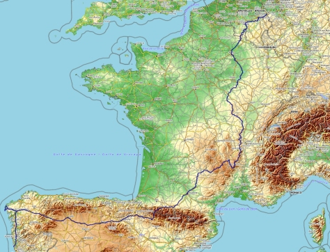
Itinerary, description of stages, practical informations, accomodation, GPS tracks of the way to Assisi from Vezelay until Cluny, for about one week walking.
When I hiked through Italy, I partly walked on Assisi way. See the page Central Apennines for example for the part between La Verna and Assisi and for Liguria or see the page Umbria-Tuscany for Via Francigena.
Way to Assisi from Vezelay to Cluny
If you start your way here, directly by crossing the Morvan Mountain, this can be a tough start with a lot of up and down paths.
The advantages:
Many lodges, refuge, huts, gites and small hotels (around 30 € -35 € per night) allow you to adapt the stages at your own pace. From Vezelay : Chastellux sur Cure, Marigny l’Eglise, Les Îles Ménéfrier, Dun les Places, Le Montal (Dun les P.), Les Settons, L’Huis Prunelle, Anost, Athez, La Rivière (Saint Prix), Glux en Glenne, Saint Léger sous Beuvray.
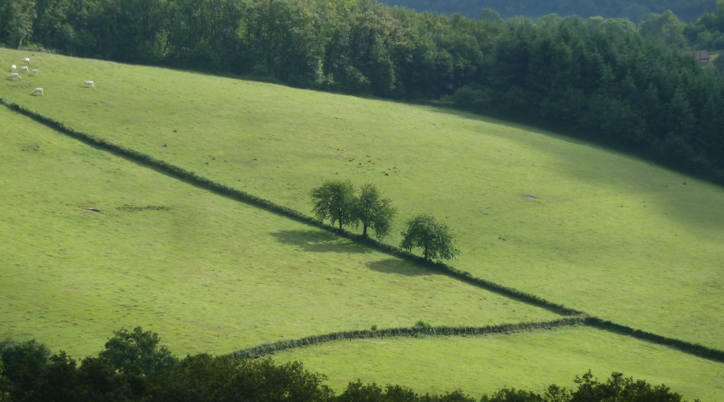
In Morvan area, there is a vast network of trails, forest roads, paths and small roads. With a good map, this allows a route « à la carte ».
Warning : it is a very rural area so you have to manage supplies. I recommend passing by Dun les Places and Anost where you can find everything you need.
Way to Assisi : I took some freedom with the « normal » way : I went up to Haut Folin (highest point in Morvan), Glux en Glenne and the Mont Beuvray.
The marks are direct from Anost to Saint Léger sous Beuvray. Then :
Broye : bed and breakfast and It seems to be possible to sleep in a castle 1 km from the village (to check)
Saint Pierre de Varennes : pilgrim accomodation (to check : Mr et Mme Boivin 03.85.80.00.71)
Rimont : pilgrim accomodation at the monastery (to check)
Web site for the way to Assisi :
Maps on the web :
France (maps of the Institut Géographique National) : http://www.geoportail.fr/ with Applestore application : Iphigénie http://iphigénie.com/?lang=en
My way from Aachen to Santiago
Linked with the image below : the GPS track of all the hike (this GPS track has been remade after the hike)
My daily stages
| 27 | |
| 23km | Stage profile : it’s beginning to be serious : the trail is entering in Morvan. It’s going up and down several times. |
| 5h45 | Notes : Very beautiful day marked GR13, Assisi way and Santiago way (the Autun to Vézelay one). Beautiful views to Vézelay at the beginning. The part in the Cure valley offers nice points of view. Then typical Morvan countryside with hamlets and villages. |
| Logistique : very typical bar in Saint André en Morvan. Accomodation in gite in a farm in Chastellux sur Cure : M. Augueux Rue de la Croix – Tel : 03 86 34 22 71 – Refuge Bahia is closed. | |
| 28 | Chastellux sur Cure – Dun les P. (Refuge de Breuil) |
| 25km | Stage profile : very hilly : steep up after Crescent lake, above Îles Ménéfrier and to reach Breuil refuge. Finally 800m of ascent during the day. |
| 6h45 | Notes : nice “mountain” stage. I followed GR 13 except before Crescent lake (more direct way through Queuzon hamlet) and detour for shopping in Dun les Places going there through L’Huis Bonin |
| Logistique : In Marigny l’Eglise, restaurant-grocery of Crescent (closed on Monday, Tuesday and Sunday afternoon and all Wednesday – menu from 9,90€) – Dun les Places : grocery with all you need, good bakery, 2 hotels-bars-restaurant (in Auberge Ensoleillée – room from 35€ – Hotel/restaurant du Montal just before going up to the refuge – The refuge of Breuil, lost in the middle of the forest (11€ The night – no restaurant – cooking facilities – Tel : 0386322555) apparently no longer accepts individual reservation, just for groups. | |
| 29 | |
| 27km | Stage profile : less hilly than the past two days. It’s going up regularly after the Settons. |
| 7h30 | Notes : from the refuge, I went by Chevresse dolmen Chevresse then the orientation table before joining back the GR13. Beautiful wild stage typical of Morvan |
| Logistics : Bar-restaurant at Gouloux waterfall – small grocery at the point where GR reach the Settons lake (no bread) – several restaurants, hotels around the lake. In L’Huis Prunelle, beautiful gite – 9,9€ per night – no restaurant but cooking facilities (Tel : 0386784033) | |
| 30 | L’Huis Prunelle – Glux en Glenne |
| 28km | Stage profile : going through Haut Folin, it’s around 600m of ascent (from Anost at 450m, it’s going up to 901m at the top) |
| 8h | Notes : From l’Huis Prunelle gite, I went on the left to Cure river source, then Anost (marked Assisi way). I followed GR13 from Anost to Corcelles. From there, I tried to use not easy trails until Haut Folin. I found back the GR13 before Glux en Glenne. It shortens the day which is already 28km long with some ascents. |
| Logistics : Anost is the place for shopping in Morvan : bakery, butchery, grocery, pharmacy, bar. In Glux en Glenne, the gite is luxurious : brand new, lounge with TV, double room with cooking facilities and private bathroom. 15€ for a bed in a room of 5 persons. 30€ in private room. Supplement if you want to use the kitchen. Restaurant-bar in Glux en Glenne. | |
| 31 | Glux en Glenne – Saint Symphorien de Marmagne |
| 37km | Stage profile : it’s almost the end of Morvan but still some rough ascents : up to Mont Beuvray (more than 250m of ascent) then around la Chapelle sous Uchon. Almost 600m of ascent for the day |
| 8h30 | Notes :Several options. The best one is perhaps to do Saint Léger sous Beuvray-Broye. As it was full in Broye, I tried to go further and so more directly : Mont Beuvray, Montandé, Château de Jeu, La Comelle, Savigny, Étang sur Arroux, La Chapelle sous Uchon, Velle Creuzille. It’s possible to avoid to go up to Mont Beuvray (historical ruins and view point). |
| Logistics : in Étang sur Arroux : all kind of shops. Gite : La Perriere – In Broye : chambre d’hôte – Saint Symphorien : B&B or hotel La Rose des Vents – To check if possible to stay at La halte 586 route du Morvan – Mme Doridot (03.85.78.20.89). | |
| 32 | Saint Symphorien de Marmagne – Montchanin |
| 19km | Stage profile : it’s going up at the beginning, easier after |
| 5h | Notes : finally not so bad at the beginning with many trails. It’s OK until Torcy through the trail going up to Brosse hill – le champ des Surelées – Montcenis – La Creuse – Étang de Torcy Neuf. Then, I recommend to go on the other side of the railway,then old Montchanin railway station. Kilometres until hotel Formule 1… |
| Logistique : Montcenis – hypermarket in Torcy before the dam on the lake. Accomodation : I stayed in Formule 1 Hotel | |
| 33 | Montchanin – St. Gengoux le N. (Burnand) |
| 31km | Stage profile : succession of hills |
| 8h30 | Notes : parallel to TGV railway on it west side going through la Galoche, then Saint Micaud, le Puley (old ruined church). Then on the east side : Bissy sur Fley ( roman church and castle) – St. Maurice des Champs (beautiful roman church – marked as Assisi way) and Saint Gengoux le National |
| Logistique : bar-restaurant in Puley. All shops in St. Gengoux. Gite next to Burnand town hall (half way arriving from Saint Martin de Croix) : call 0385926217 – 5,7€ Per night (kitchen, bathroom). | |
| 34 | Saint Gengoux le National (Burnand) – Cluny |
| 24km | Stage profile : quite easy, just 400m of altitude above Collonges |
| 6h | Notes : Beautiful day following the GR76 – hills, vineyards, beautiful stone walls – well marked with Santiago shells |
| Logistique : bar-restaurant in Curtil sous Burnand otherwise nothing until Cluny – in the camping, tent for pilgrims 3,8€ – bunk bed in Cluny Séjour (Tel : 03 85 59 08 83) : it’s better to make a reservation as it’s often full, especially on weekend days. | |
When I hiked through Italy, I partly walked on Assisi way. See the page Central Apennines for example for the part between La Verna and Assisi and for Liguria or see the page Umbria-Tuscany for Via Francigena.
